


Winter Conditions Are Headed Our Way, How Will We Be Affected?
- G-Weather
- Feb 10, 2021
- 4 min read

Looking back on January, temperatures and precipitation remained above normal on average. Temperatures did cool briefly to get our first snow event down to the lower elevations. GFS model was the most accurate looking into the extended period on that specific model run I showed in my last blog post. In result, that officially gave Portland a trace of snowfall with parts of the metro area up to 2 inches. The further southwest you were is where more snow accumulated on the valley floor, generally 2 to 4 inches. Didn't see much more than a half of foot of snow in higher elevations and up into the mountains as precipitation was light across the state. Although everyone saw snowflakes, not everyone experienced measurable snow. You may have heard a rumor of a "true" snowstorm coming, these are my thoughts.
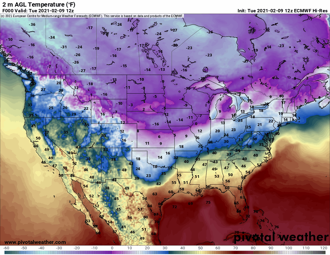
Polar Vortex is making an appearance into the midwest as it spills in from Canada, temperatures below zero degrees expected over there at times. Pacific Northwest is on the back edge of the frigid air. Temperatures look to dip into the 20's at night and 30's during the day for Northwestern Oregon, with 10's at night and 20's during the day for Northeastern Oregon heading into the weekend. Notice how the rest of Oregon is warmer, while Washington taps into colder air. That's due to a different wind direction filtering warmer air heading south. What does that mean for snow?

This is a look at the total snowfall across our region on Thursday into Friday, according to this morning's run of the operational European modeling. That would be the first chance for snow, accumulating 1 to 3 inches at Portland with nothing south of Wilsonville as the east wind doesn't make it into much of the Willamette Valley. This model targets Olympia for a potential snowstorm in the lowlands, accumulating nearly 10 inches. The gorge and cascades could get dumped on 1 to 2 feet, with 4 to 6 inches possible for Eastern Oregon and 1 to 3 inches heading into Central Oregon.

Same time frame, but with operational American modeling. This pushes the snow chance slightly further south, 2 to 4 inches in Portland and a trace to 1 inch from Wilsonville to Salem. This model targets Longview to Olympia for a potential snowstorm in the lowlands, averaging a foot. If this were to verify, snow is projected to be more widespread on the east side of the state.

This is the operational Canadian modeling, with the same time frame. This model targets Portland to Longview for a potential snowstorm, averaging 10 inches. Lighter amounts expected from Wilsonville to Salem, accumulating 1 to 3 inches. It shows 4 to 8 inches on average for Eastern Oregon, with 1 to 3 inches for Central Oregon.

This is the total snowfall through Sunday evening, according to the operational European modeling. Keep in mind, this weekend is lower in confidence as it's farther away. But it shows nearly 10 inches by this time in Portland, with more expected north and much less south. Buries the gorge and cascades in 2 to 3 feet of snow, nearing a foot in Eastern Oregon and averaging 6 inches in Central Oregon.

Same time frame, but with the operational American modeling. This model buries Longview to Olympia, along with the gorge and cascades up to 2 feet of snow. It gives Portland up to a foot, with 3 to 6 inches from Wilsonville to Salem and a trace to 1 inch throughout the remainder of the valley. For the east side of the state, it drops 4 to 8 inches on average.

This is the operational Canadian modeling, with the same time frame. It gives 1 to 2 feet of snow from Portland to Olympia and through the gorge and cascades. Accumulating 4 to 8 inches from Wilsonville to Woodburn and trace amounts possible from Salem and to the south. This model projects 6 to 14 inches for Eastern Oregon, with less in Central Oregon.

Although models disagree on specific amounts, they all agree that the best chance for widespread snow in the lowlands will be near Portland and to the north. The remainder of the valley looks to miss out on the bulk of it, but still keep an eye out for something. Best chance for accumulating snow on the coast will be further up north into Washington. The gorge and the mountains, along with the lowlands of Washington will have the best chance to see the most snowfall. Areas that are slow to cool the upper atmosphere will experience freezing rain. Anyone across the region could see receive spotty ice with no major issues. That could be a different story from Wilsonville to Salem, where models insist on potentially hazardous ice accumulations on Thursday or Friday. I think that it is likely that much of us will experience more wintry precipitation than we have in a while, but the placement of the low pressure system and the direction of the wind will determine how everything plays out. Don't put too much stock into the exact snowfall yet, forecasts models can change to different solutions several times a day. But as for now, the best chance for the heaviest snowfall will be on Saturday. Stay tuned as it will be clearer heading in the coming days.
- Gabe Curtis, EOAliveTV's Official Forecaster and Creator of G-Weather


Comments